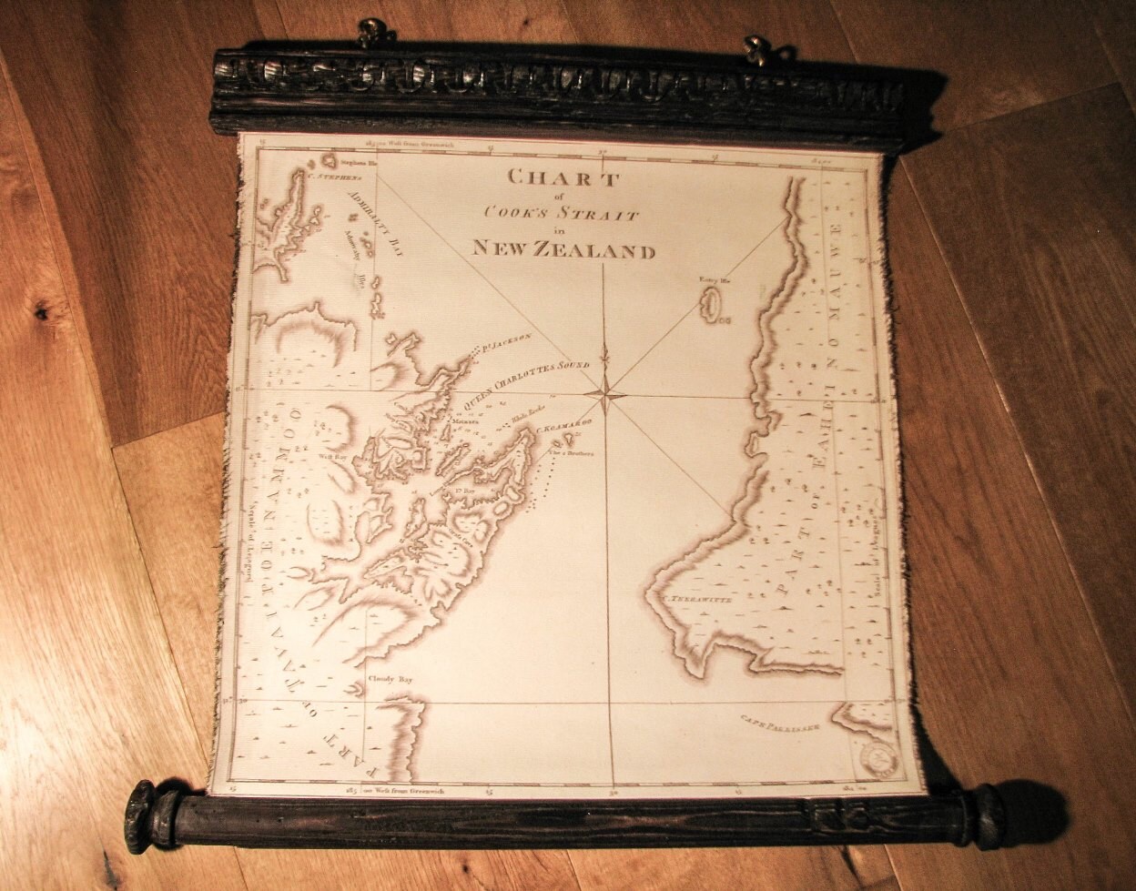

Pull down map Of Cook Strait, New Zeland in 1733, James Cook's map, Canvas Antique Wooden Iron Pirate Frame
$173.85
Map is sold already, but we will create a new one for you, in any size you need.
- Size of the map from photos 51 x 74cm / 20'' x 29'' (possible any other size, contact us)
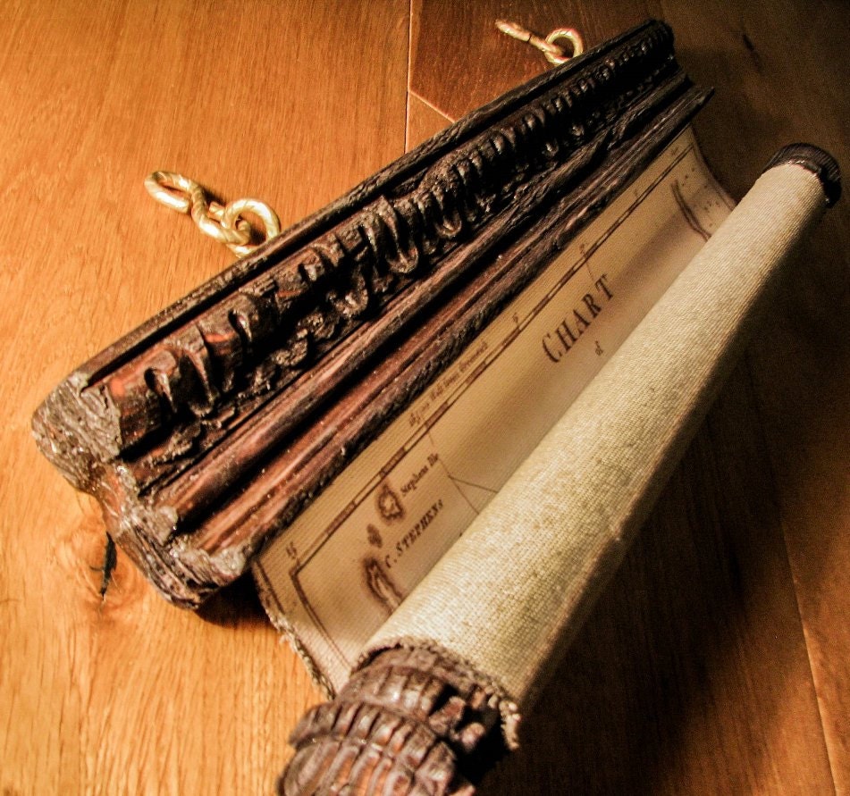
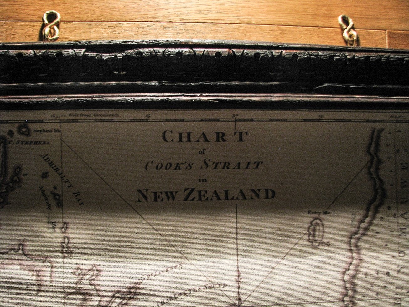
Chart of famous Cook strait in New Zealand, beautiful old map, y.1733, ready for your wall:
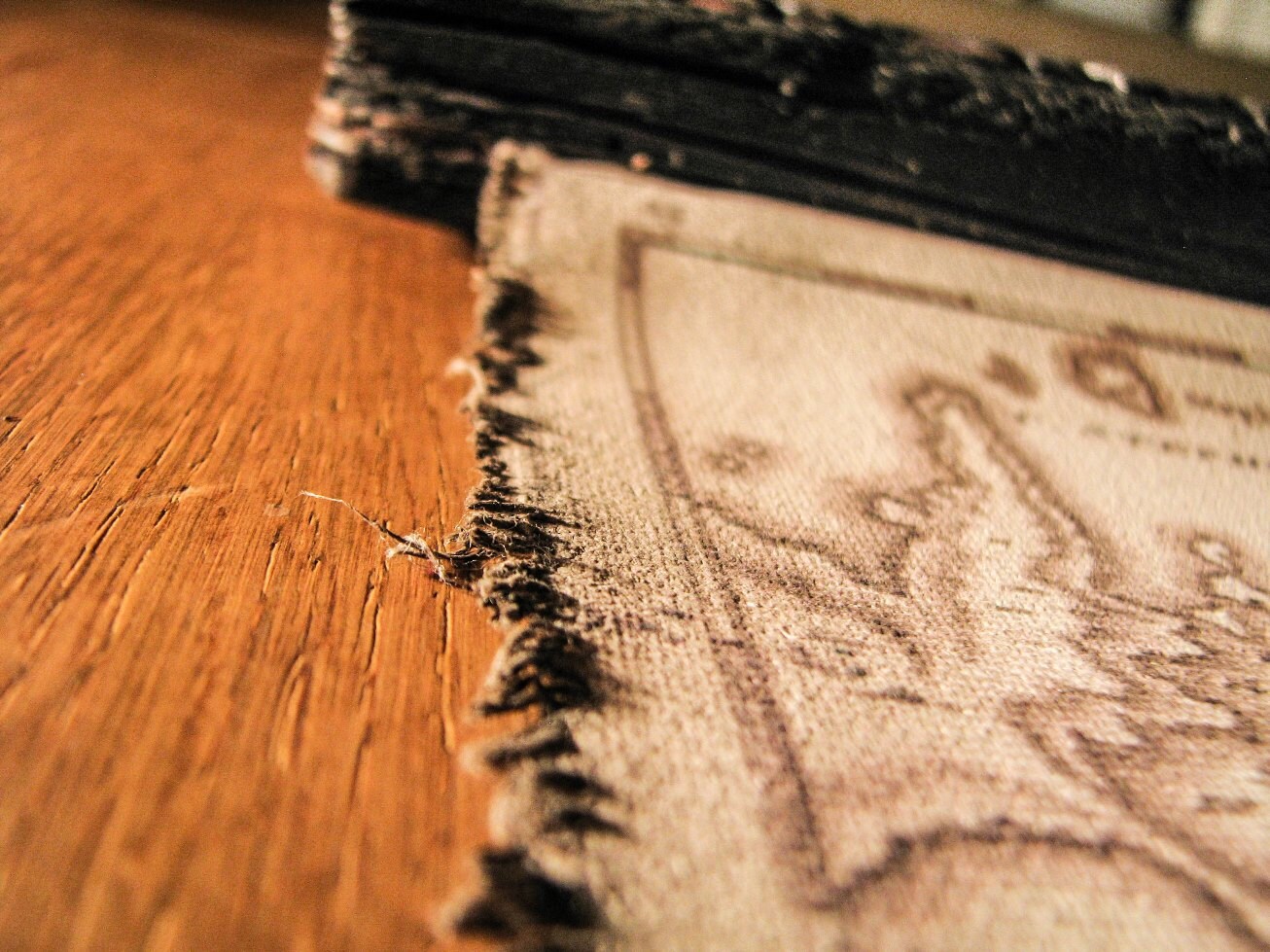
- High resolution map with hand made antique finish on durable cotton canvas.
- Map is readable.
- Frame is hand made of solid rustic wood dark brown, with iron hangings in gold patina.
- Hand-carved woodwork
Its a true pirate map with unique frame, and the powerful content of the map always attracts attention of your guests, visitors...
Your map will last for generations!
Contact us for any further information. We want to meet you and discuss the details and your wishes about the order.
★★★ Click out Etsy Zmaps shop https://www.etsy.com/shop/Zmaps?ref=shopsection_shophome_leftnav
★★★ Click our web site www.oldmap.si/eng
★★★ Click & like our facebook page https://www.facebook.com/pages/ZMAPS-unique-wall-decor/149547135121317?ref=hl
Returns & Exchanges
I gladly accept returns, exchanges, and cancellations
Just contact me within: 14 days of delivery
Ship items back to me within: 45 days of delivery
Questions about your order?
Please contact me if you have any problems with your order.
Frequently Asked Questions
Sizing details
Our focus is on creating largest wall maps on market. Each map we make is one of a kind project, perfectly matching your interior. Tell us what map size you are looking for and we will point you in the right direction.
Quality over quantity!
Custom and personalized orders
Each map we make is one of a kind project, perfectly matching your interior. Contact us, we believe we will help you find a perfect solution for your wall or a unique custom gift for special person. You can even pay with Crypto.
Shipping times
- US, Canada, Australia / shipping time 2-6 working days
- Europe / shipping time 2-3 working days, possible personal pickup
Can I pay with Crypto?
Well yes, crypto payments are accepted. It's easy, just simply contact us and we will guide you further. You can reach us via Etsy chat or send email to blazblaz@gmail.com